Finally, DJI is bringing in a more affordable enterprise drone in the last quarter of 2022. Introducing Mavic 3 Enterprise Series, with currently 2 options which is Mavic 3 Enterprise (M3E) and Mavic 3 Thermal (M3T).
From the specification of the drone, M3E is more suitable in mapping related jobs and M3T is more suitable in aerial surveying or inspection.
Both M3E and M3T have a battery life of 46 minutes, omni directional sensing, better obstacle avoidance, and equipped with ½ inch CMOS 12 megapixel tele camera. But the M3E has a 4/3 CMOS sensor 20 megapixel wide camera with mechanical shutter, which allows it to capture a high resolution picture at higher speed and reduce rolling shutter effect. And M3T has a ½ CMOS sensor 48 megapixel wide camera with electronic shutter, and additional Uncooled VOx Microbolometer as thermal camera with a resolution of 640x512.
Enough of the specification, how would it apply into operation?
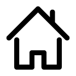
For M3E, as mentioned previously where it is more suitable in mapping. Rather to say suitable, it caters for mapping. There are many types of mapping, however the most basic would be Orthography and Topography. Orthography refers to bird view of the location or google satellite view. Topography refers to topographic area data of designated areas. And there is 3D mapping which constructs an object into a 3 dimension view. Below is example of the data obtain using M3E
Results from M3E show high quality of orthography, topography data, 3D data.
M3T is suitable for inspection, search and rescue due to its thermal camera. Inspections such as solar farms, electric towers, will be an easy task for M3T. Of course with the application of thermal cameras, detection of survivors will be easier during search and rescue missions.


Above are some data that was collected during testing of M3T. However, applications are still very wide. Using the same tech, detection of gas leaking, protection and observation of wildlife, etc can be done.
Drone tech is advanced and has many applications. Imagination is what is required to apply into operation. And with the Mavic 3 Enterprise series launched, a much affordable drone can be implemented into business operation. A future with drones applying into business operations will be coming soon.
Application Used
Mavic 3 Thermal (M3T)
M3T is suitable in many applications such as inspection and Search and Rescue. However M3T mostly will be used in Inspection work due to its Thermal camera and also Zoom camera.
Previously, inspection tasks required people to manually climb the building to inspect the condition. But the problem is that it can risk the safety of the person and is time consuming. Sometimes there are areas that are hard to access, and this can cause a problem. Here is where the drone comes into usage. With new M3T that equipped with a Thermal camera and Zoom Camera, job will be more efficient, easier and safer to be done.
Thermal camera can be used to inspect any gas leak from the gas tank. For some gas that is hard to visualize with a visible eye, thermal cameras can easily generate the image. Apart from gas leak, thermal also can be used to check roof top water leak. When the leak happens on the roof, there will be a hotspot difference between a roof that doesn't leak and a roof that has a leak. In another case, thermal also can be used to inspect a solar panel condition. Based on the photo above can be seen that there is different between the solar absorption at the spot with other area, it means is that the solar panel in the area has problem and need to be check.
In Search and rescue missions, thermal cameras also can be used. As it is known that the human body emits heat, rescue teams can easily identify the person in a dark environment without needing to rely on a search light but just thermal cameras. Other than detecting people, thermal also can be used to detect animals at night. The Wildlife Department may check the animals that are active at night, by using Thermal cameras they will be able to detect the target.
Mavic 3 Enterprise (M3E)
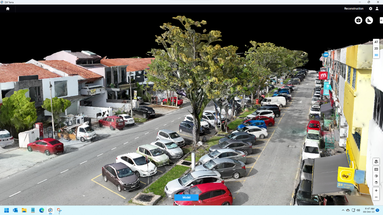
M3E is equipped with a 20MP 4/3 Inch Sensor and mechanical shutter camera. For this, M3E is suitable to be used in mapping jobs. Mapping using drones users can obtain two types of data, the first data is Orthophoto and second data is Topography data. Orthophoto is a data map that shows a bird's eye view of the location of the mapping . As can be seen in the photo above, users can easily check any feature in the survey area, for example users can measure the road length, road condition, house size and many more.
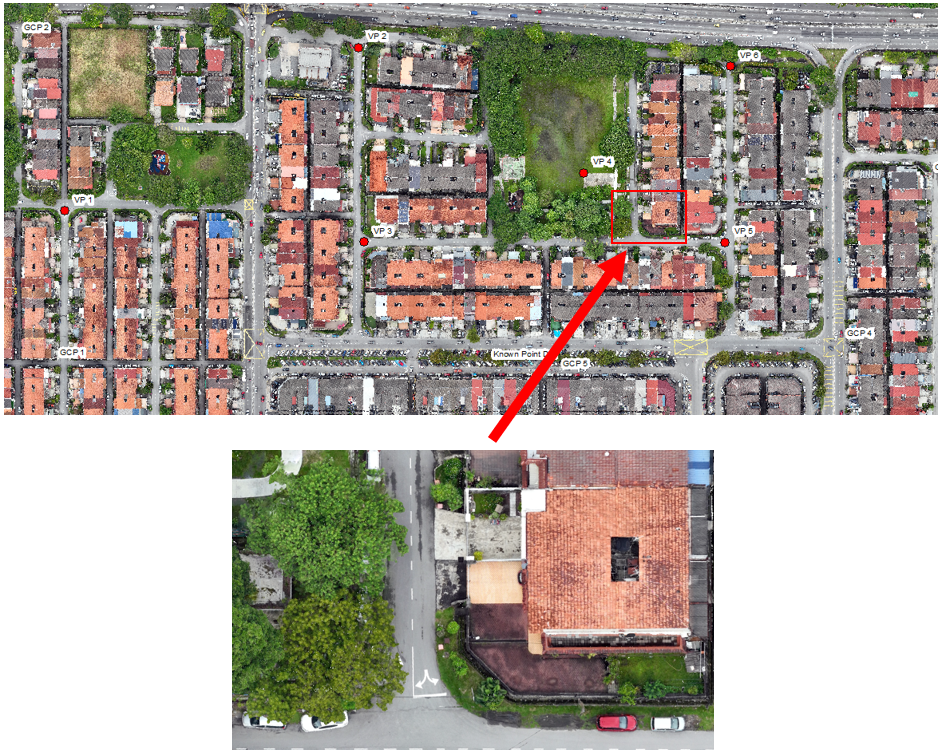
As before this to get a topographic data of a curtain area, users need to use a survey instrument to obtain topographic elevation of the area, this method is very time consuming and the elevation data that is obtained is not very dense. But with drone technology this data can easily be obtained. Drones use a photogrammetry concept to get the topography data of the area.