One tool in particular has boosted precision agriculture's potential to new heights: the drone. Drone data and an aerial view of your fields can help you make more educated decisions, remove guessing, and anticipate problems before they occur. There are several important tasks that can be handled by non-labour intensive option - Drone Operation.
Contour Mapping:
A drone can help you map out your property before you start planting so you can make the best decisions about plot management. You can use photogrammetry or Lidar to build 3D maps based on your drone's cameras and sensors to measure the topography of your property. This information can identify high- and low-points, as well as areas where soil erosion may occur or where irrigation problems may exist. With this knowledge, you can plan ahead of time and avoid problems before they arise.
Irrigation
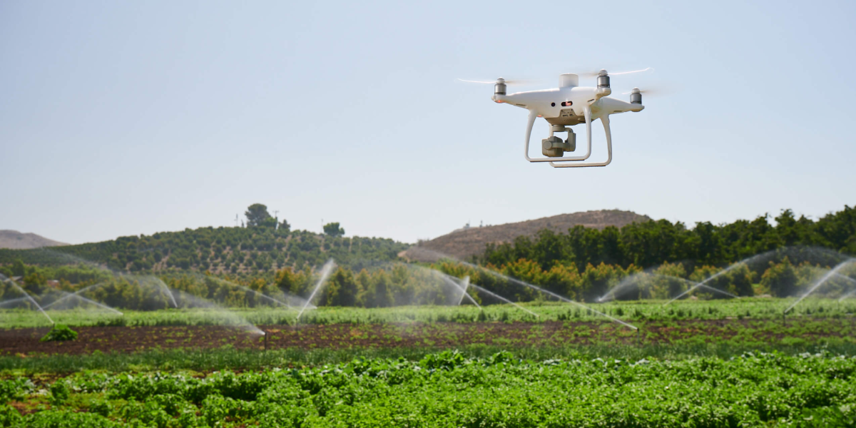
Phantom 4 Multispectral drone can track watering of crops both. Following the planting of crops, spectral or thermal photography from above can reveal which plants or portions of your field have too much or too little water. With this knowledge, you can address your crops' thirst before it becomes a serious problem.
Crop Assessment
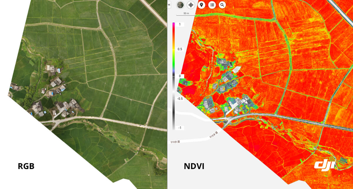
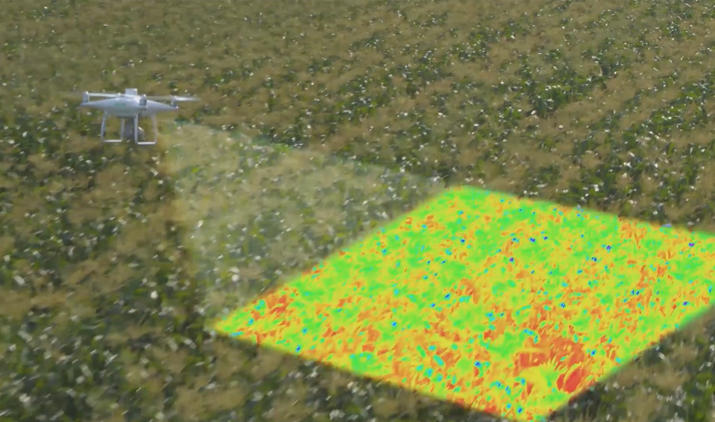
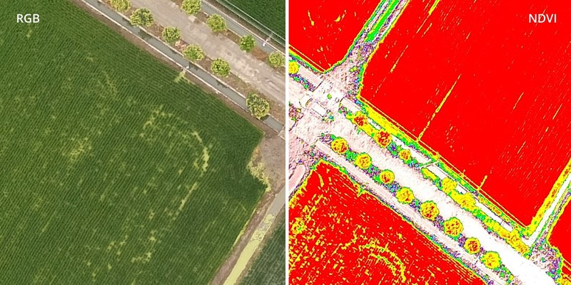
Agriculture drones can provide some of the most essential insights into the health and care of your crops. If your drone has a multispectral camera, it can make Vegetation Index (VI) maps, which provide important information about your crops. The Normalized Difference Vegetation Index (NDVI), for example, can reveal which plants are healthy and which are not. The amount of near-infrared (NIR) light reflected from your crops' leaves is used to determine NDVI. Sickly, stressed, or dehydrated leaves absorb more NIR light, whereas healthy leaves reflect more. Depending on the resolution, an NDVI map collected and generated by a drone can show you which areas of your fields, which plants, or even which parts of individual plants need attention.
What drone can be used for these agriculture tasks?
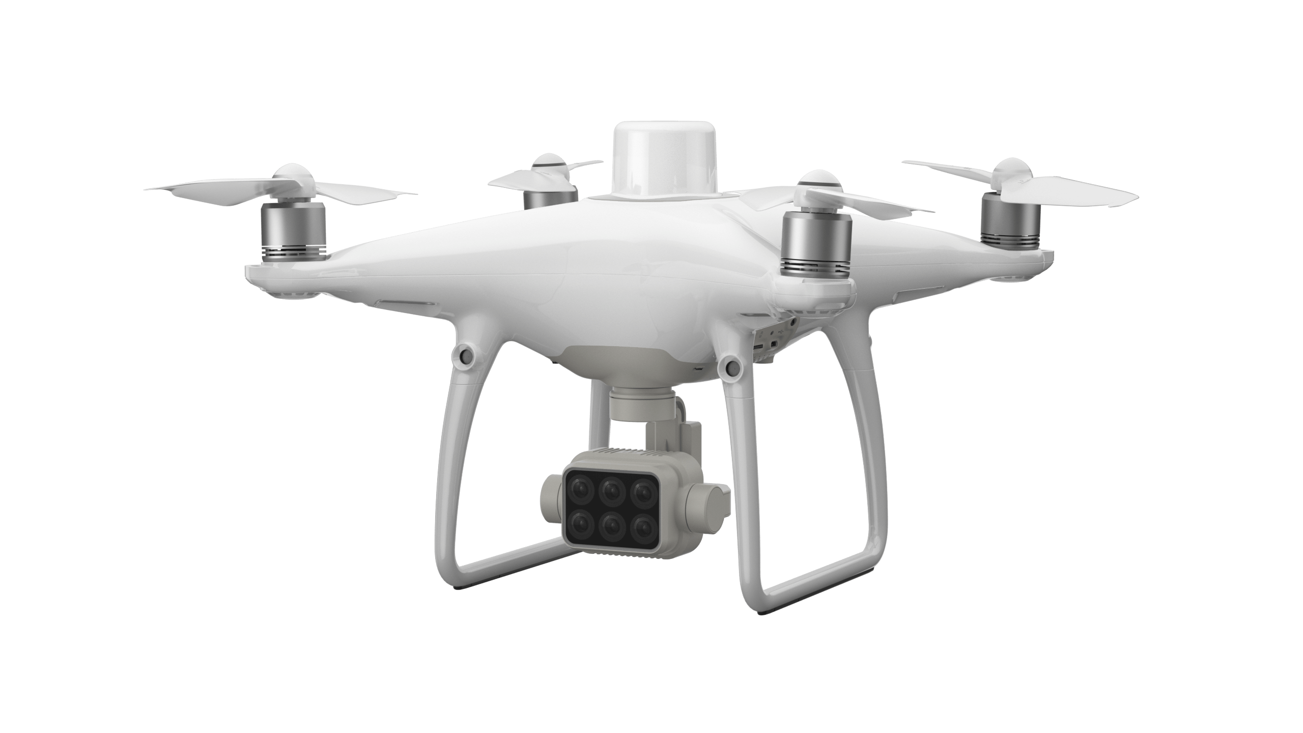
The DJI P4 Multispectral (P4M), was created exclusively for the agriculture business. Thanks to its multispectral camera array, this highly accessible instrument may be seamlessly incorporated into agriculture operations and can dependably capture multispectral imaging data. The P4M can record imaging data with centimeter-level accuracy thanks to a built-in RTK module and an Integrated Spectral Sunlight Sensor.
Want to acquire or learn more about DJI drones and payloads?
Contact us on WhatsApp to see which drone suits your work or operations nature the most.